AeroIntel Drone Solutions
  • Services
  • About
  • Gallery
  • Industries
  • Contact
Request Inspection
Project Gallery

Mission
Archive

Real inspection and mapping missions completed by AeroIntel Drone Solutions — RGB visual captures and thermal IR imagery from the field.

6 images from completed missions

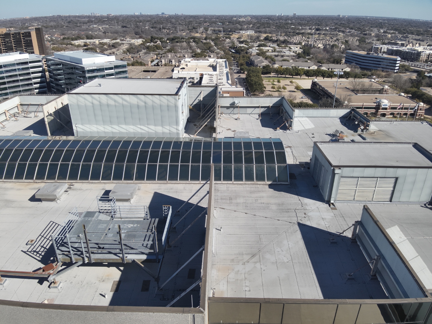
Commercial rooftop inspection — aerial nadir view of multi-building commercial complex
Click to enlarge

Commercial Rooftop Inspection

Aerial nadir view of a multi-building commercial complex documenting roof condition, HVAC equipment, skylight structures, and membrane surfaces.
RGB Visual Roof Inspection DJI Mavic 3T
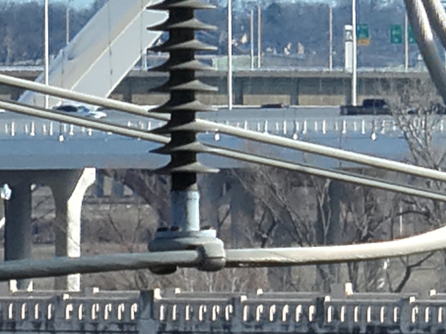
Close-range inspection of power line insulator and hardware
Click to enlarge

Power Line Infrastructure

Close-range visual capture of a high-voltage insulator and conductor hardware — documenting component condition for utility maintenance planning.
RGB Visual Infrastructure Close-Range
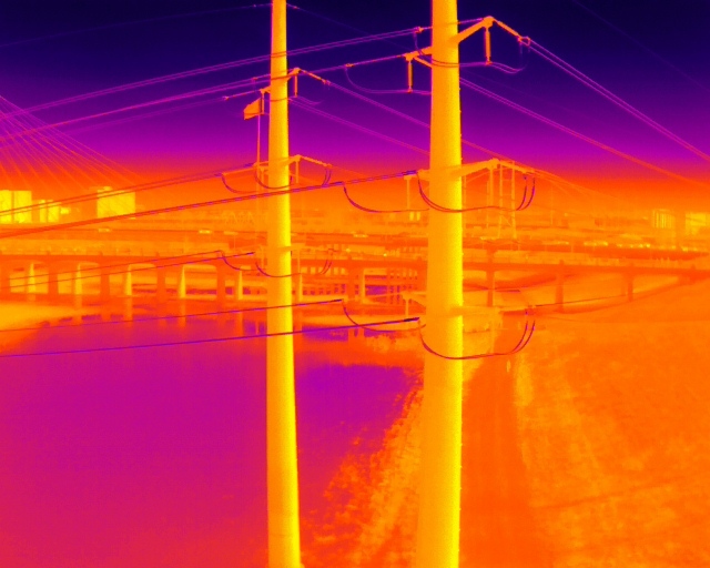
Thermal IR Thermal imaging scan of power lines and bridge infrastructure
Click to enlarge

Thermal — Infrastructure Survey

Infrared thermal scan of utility poles, power conductors, and bridge infrastructure identifying heat signatures and thermal anomalies across multiple assets.
Thermal IR Infrastructure Utility Survey
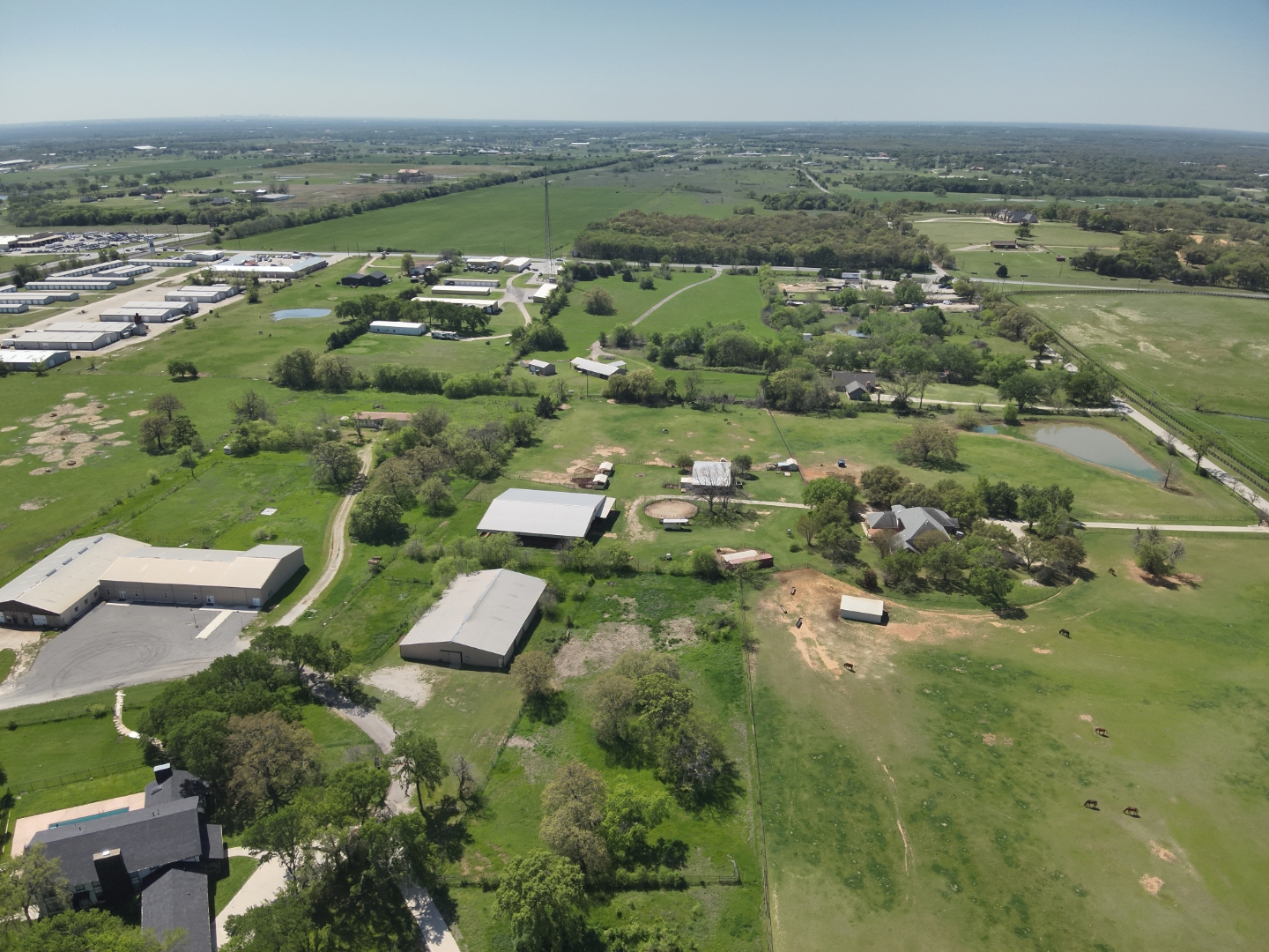
Aerial mapping survey of rural property with buildings and land features
Click to enlarge

Aerial Property Mapping

High-altitude aerial survey capturing a rural property with multiple structures, access roads, fencing, and land features for site documentation and planning.
RGB Visual Aerial Mapping Site Survey
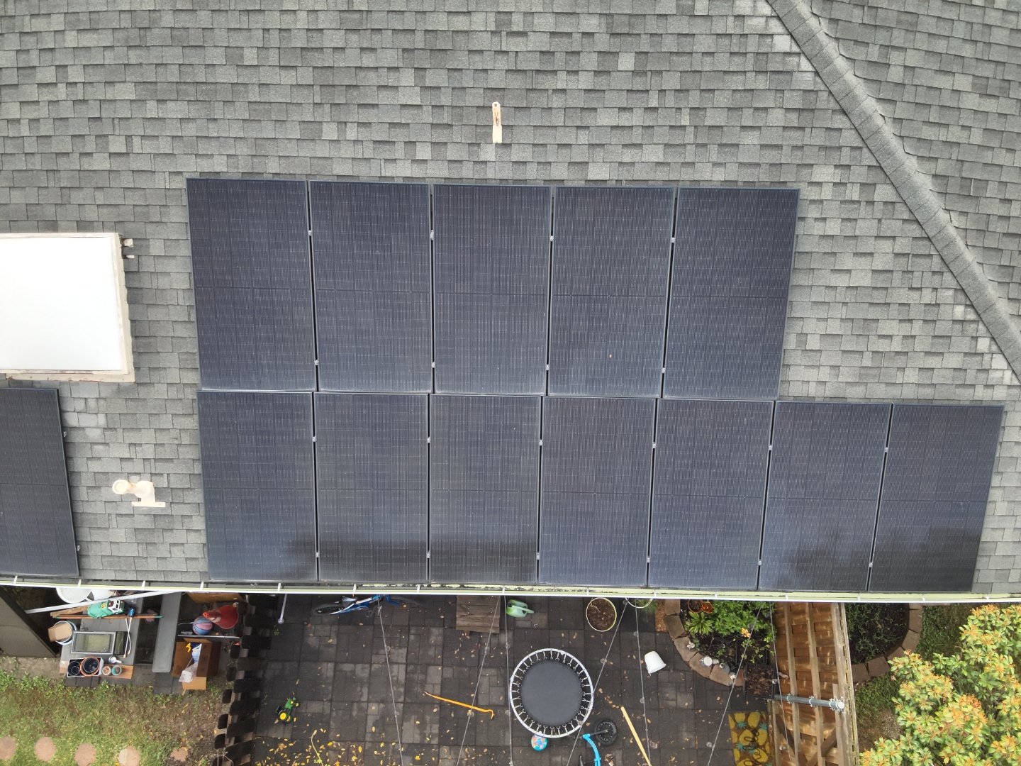
Nadir view of residential rooftop solar panel array inspection
Click to enlarge

Residential Solar Inspection

Nadir RGB capture of a residential rooftop solar array — documenting panel layout, mounting hardware, shingle condition, and overall array configuration.
RGB Visual Solar Panels Residential
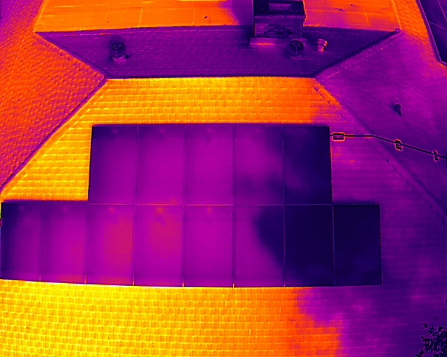
Thermal IR Thermal imaging scan of rooftop solar panels showing heat distribution
Click to enlarge

Thermal — Solar Panel Scan

Infrared thermal image of a rooftop solar array showing heat distribution across panels and surrounding roof surface — used to identify underperforming cells and hotspots.

Thermal IR Solar Panels Hotspot Detection

Have an asset that needs inspection or mapping? AeroIntel delivers this level of detail on every mission.

Request an Inspection →
AeroIntel Drone Solutions

AeroIntel Drone Solutions delivers precision aerial inspections, thermal imaging, and mapping services for critical infrastructure across North Texas and nationwide.

Services
  • Roof Inspections
  • Solar Panel Scans
  • Pipeline Surveys
  • Cell Tower Inspection
  • Aerial Mapping
Company
  • About AeroIntel
  • Project Gallery
  • Contact
  • Request Inspection
Connect
  • (571) 216-2712
  • info@aerointels.com
  • aerointels.com

© 2026 AeroIntel Drone Solutions, LLC — Frisco, Texas. All rights reserved.

FAA Part 107 Fully Insured DJI Mavic 3T SBA Service-Disabled Veteran-Owned Certified